
August 5, 2026
Base Flood Elevation Explained for Homeowners and Contractors

Base Flood Elevation Explained for Homeowners and Contractors
Base Flood Elevation (BFE) is the water-surface elevation that a flood has a 1% chance of reaching or exceeding in any given year, as defined by FEMA for the National Flood Insurance Program. For permits, your lowest floor and critical mechanical equipment must meet or exceed that elevation, often plus a local freeboard margin. For insurance, BFE determines whether your property sits in a Special Flood Hazard Area, which typically triggers mandatory flood coverage and elevation documentation requirements from lenders.
Table of Contents
- What base flood elevation is and how engineers calculate it
- Where to find the BFE for your property
- What BFE means for your building permit and construction plans
- What to do when the FIRM shows no printed BFE
- How BFE affects your flood insurance and lender requirements
- Your step-by-step checklist for BFE compliance
- Authoritative resources for permit-ready BFE verification
- Key Takeaways
- The part most permit packages get wrong
- Miamipermitai catches BFE permit issues before Miami-Dade does
- Useful sources
What base flood elevation is and how engineers calculate it
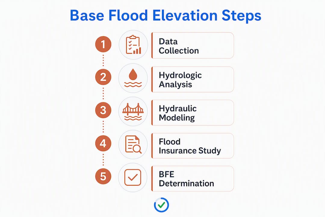
BFE is a modeled water-surface elevation, not a fixed land height. Engineers derive it through a two-step workflow:
- Hydrology first. Tools like HEC-HMS estimate how much runoff a watershed produces during the 1%-annual-chance storm, accounting for rainfall, soil type, and drainage area.
- Hydraulics second. HEC-RAS then routes that runoff through channels and floodplains, computing the water-surface elevation at each cross section. Those elevations become the BFEs plotted on the map.
The results feed into a Flood Insurance Study (FIS), which documents the analysis in detail, and a Flood Insurance Rate Map (FIRM), which displays BFEs graphically for zones AE, AH, A1–A30, AR, V1–V30, VE, and related designations. FEMA’s BFE mapping guidance notes that BFE lines may appear as whole-foot rounded values or to the tenth of a foot, with decimal precision increasingly common in flat terrain where small elevation differences matter most.
BFE values are not permanent. New hydrology data, updated modeling methods, or changes to a watershed can all trigger a map revision. Treat any BFE you find as current only if the FIRM panel date is recent.
Pro Tip: Before finalizing any design or permit submission, confirm the BFE with your local Floodplain Administrator. A preliminary value from an older map or a quick online lookup can differ from the permit-grade figure the county requires.
Where to find the BFE for your property
BFEs appear on FIRMs and in FIS reports. FEMA and local government offices are the authoritative sources.
| Source | What it provides | Best use |
|---|---|---|
| FEMA Map Service Center | Current FIRM panels by address or panel number | Quick zone and BFE lookup |
| Flood Insurance Study (FIS) | Cross-section profiles and tabulated BFEs | Permit-grade elevation data |
| Local Floodplain Administrator | Official BFE confirmation and local amendments | Permit submission requirements |
| County GIS portal | Parcel-level flood zone overlays | Preliminary site screening |
To look up your property:
- Go to the FEMA Map Service Center and enter your address to pull the current FIRM panel.
- Download the FIS for your community to find cross-section tables with precise BFE values.
- Call or visit your local Floodplain Administrator to confirm the permit-level BFE and any local amendments.
If your property sits in a zone starting with A or V, expect stricter construction requirements and a printed BFE or a cross-section reference in the FIS.
What BFE means for your building permit and construction plans

BFE is the regulatory anchor for every elevation-related decision in your permit package. Your lowest floor elevation must meet or exceed BFE, and most jurisdictions add a freeboard requirement of 1–3 feet above BFE. Confusing freeboard with BFE is one of the most common plan errors reviewers catch.
Common permit requirements tied to BFE:
- Lowest floor elevation at or above BFE plus local freeboard
- Mechanical, electrical, and HVAC equipment elevated above BFE
- Foundation type appropriate to the flood zone (fill, piers, or elevated slab)
- Flood vents or openings in enclosed areas below BFE
- Anchoring of utilities and fuel tanks
- An elevation certificate documenting compliance before or at final inspection
V zones and VE zones carry additional requirements because wave action, not just stillwater flooding, drives the design loads. Older coastal FIRMs sometimes showed only stillwater elevations, which excluded wave effects. Modern codes address wave heights explicitly, so if you are working from a pre-1981 FIRM for a coastal site, verify current wave-inclusive requirements in the FIS or a newer study before selecting your foundation system.
Permitting authorities routinely reject or delay packages when elevation documentation is missing or references an unverified BFE. An elevation certificate is not just an insurance document; it is evidence of permit compliance.
What to do when the FIRM shows no printed BFE
Zone A on a FIRM sometimes lacks a printed BFE. That does not mean you can skip the elevation requirement. It means you have to derive one.
Your options, in order of effort:
- Check the FIS cross-section tables. The study may include a BFE for a nearby cross section you can reference.
- Use FEMA’s BFE Interpolate Tool for a preliminary estimate. This works for riverine sites and gives a starting point, not a permit-ready number.
- Hire a licensed civil engineer to produce a formal BFE determination using hydraulic modeling. For permit-grade work in jurisdictions like Miami-Dade, an engineer’s analysis supported by HEC-RAS or verified cross-section interpolation against the FIS is typically required.
If site conditions or new study data justify changing the mapped BFE, the formal path is a Letter of Map Revision (LOMR), submitted to FEMA. A LOMR takes time and documentation, but it is the only way to officially update the map for your parcel.
Relying on a rough interpolation for permit submission is high risk. A rejected permit means redesign costs and timeline delays that far exceed the cost of an engineering study upfront.
How BFE affects your flood insurance and lender requirements
BFE determines whether your structure sits in a Special Flood Hazard Area. If it does, and your mortgage is federally regulated, flood insurance through the NFIP is typically mandatory. Your lender will usually require proof of coverage and an elevation certificate before closing.
The elevation certificate drives your NFIP premium. The higher your lowest floor sits above BFE, the lower your premium tends to be. A structure built one foot below BFE can carry a significantly higher annual premium than one built two feet above it. That gap compounds over a 30-year mortgage.
BFE-driven design changes add cost: raised foundations, engineered fill, elevated mechanical systems, and the elevation certificate itself all carry fees. Construction finance rates have pushed some Florida builders to reconsider project scope when BFE compliance adds meaningful square footage to foundation costs. Budget for these early. Discovering a freeboard requirement after framing has started is an expensive surprise.
Check both your lender’s requirements and your municipality’s floodplain ordinance. Local rules sometimes exceed NFIP minimums.
Your step-by-step checklist for BFE compliance
- Pull the current FIRM panel for your address at the FEMA Map Service Center and confirm your flood zone.
- Download the FIS for your community and locate the cross-section tables for your site.
- Contact your local Floodplain Administrator to confirm the permit-level BFE and any local freeboard requirements.
- Order an elevation certificate from a licensed surveyor or engineer before or during permit submission.
- Include the FIRM panel number, FIS cross-section reference, and elevation certificate in your permit package.
- If no printed BFE exists, engage a licensed civil engineer before submitting, not after a rejection.
- Verify your insurer and lender requirements separately from the permit office. They sometimes ask for additional documentation.
When you contact the permit office, bring your property address, parcel ID, site plans, and the elevation certificate. The Floodplain Administrator is your first call for zone and BFE questions. Bring in a licensed engineer when the map lacks a printed BFE or when the permit authority requires a formal elevation determination.
Authoritative resources for permit-ready BFE verification
Start with the FEMA Map Service Center and your local Floodplain Administrator for any permit-level BFE question.
| Resource | What it contains | When to use it |
|---|---|---|
| FEMA Map Service Center | Current FIRM panels | First lookup for any property |
| FEMA BFE Mapping Guidance | How BFEs are plotted and precision standards | Understanding map methodology |
| Flood Insurance Study (FIS) | Cross-sections, profiles, tabulated BFEs | Permit-grade elevation data |
| HEC-RAS / HEC-HMS | Hydraulic and hydrologic modeling software | Engineer-level BFE derivation |
| FEMA BFE Interpolate Tool | Preliminary BFE estimates for Zone A | Pre-engineering screening only |
| Local Floodplain Administrator | Official BFE confirmation, local amendments | Permit submission confirmation |
Sequence: look up the FIRM, review the FIS cross-sections, confirm with the local Floodplain Administrator, then engage a licensed engineer if the permit requires formal elevation documentation.
Key Takeaways
BFE is the 1%-annual-chance modeled water-surface elevation that drives every permit and insurance decision for properties in FEMA flood zones.
| Point | Details |
|---|---|
| BFE definition | The water-surface elevation with a 1% annual chance of being reached or exceeded, shown on FIRMs for AE, VE, A1–A30, and related zones. |
| Permit anchor | Lowest floor and mechanical equipment must meet BFE plus any local freeboard of 1–3 feet required by your jurisdiction. |
| Insurance driver | BFE determines SFHA status; higher floors above BFE generally reduce NFIP premiums and satisfy lender documentation requirements. |
| Missing BFE | Use FIS cross-sections or FEMA’s BFE Interpolate Tool for screening, then hire a licensed engineer for permit-grade determinations. |
| Miamipermitai | Miamipermitai reviews Miami-Dade permit packages against FEMA flood zones, FIRMs, and elevation documentation before you submit, flagging BFE-related gaps that cause rejections. |
The part most permit packages get wrong
The single most common BFE-related failure in permit packages is not a wrong number. It is a missing document. Contractors submit plans that correctly show the lowest floor elevation above BFE, but they leave out the elevation certificate, or they reference a FIRM panel that has since been superseded. The permit office flags it, the clock resets, and a project that was ready loses weeks.
The second mistake is treating BFE as a ceiling rather than a floor. BFE is the regulatory minimum. Local freeboard rules, lender requirements, and the practical reality of climate-adjusted flood risk all push the smart design target higher. A structure built exactly at BFE is compliant today. Whether it stays compliant through the next map revision is a different question.
For coastal sites in Miami-Dade and similar markets, the gap between an old FIRM’s stillwater BFE and what modern wave-action analysis requires can be substantial. Verifying against the current FIS, not just the map panel, is the step most homeowners skip and most contractors assume someone else handled.
Miamipermitai catches BFE permit issues before Miami-Dade does
Flood zone compliance is one of the top reasons Miami-Dade permit packages come back with corrections. Missing elevation certificates, unverified BFE references, and plans that show the right floor height but cite the wrong FIRM panel are all fixable problems, but only if you catch them before submission.
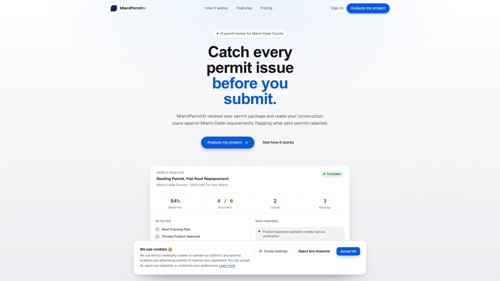
Miamipermitai reviews your permit package against FEMA flood zones, current FIRMs, and Miami-Dade elevation documentation requirements before you submit to the county. The platform checks plan consistency, flags missing documents, and gives you a readiness score with a plain-language fix list. It also verifies Miami 21 zoning compliance and Florida DBPR contractor licensing in the same review. After submission, it tracks your permit through approval using public Miami-Dade records and sends status updates by email.
Check your permit package at Miamipermitai before your next submission and see exactly what needs to be corrected. Still confirm jurisdiction-specific BFE requirements with your local Floodplain Administrator, but go into that conversation knowing your documentation is already in order.
Useful sources
Start with the FEMA Map Service Center for a quick panel lookup, then contact your local Floodplain Administrator for permit-level confirmation.
- Base Flood Elevation (BFE) | FEMA.gov — official FEMA definition and zone list
- National Flood Insurance Program Terminology Index | FEMA.gov — NFIP terms including FIRM, SFHA, and BFE
- Guidance for Flood Risk Analysis and Mapping, Mapping BFEs on FIRMs | FEMA — how BFEs are plotted and precision standards
- How to Determine BFE Outside the Floodplain | Louisiana DOTD / FEMA — methods for deriving BFE when not pre-printed
- BFE in Zone A Guidance | Utah Division of Water Resources — practical guidance for Zone A BFE determinations
- HEC-RAS and HEC-HMS documentation — available through the U.S. Army Corps of Engineers Hydrologic Engineering Center for engineers conducting hydraulic and hydrologic modeling
Recommended
Is your permit package ready?
Run an AI readiness check against Miami-Dade requirements before you submit.
Try your first analysis freeThis article is general guidance and not legal, engineering, or official county advice. Always verify requirements with Miami-Dade County before submitting a permit.